Log in
All resources
Create a design
39 Free Images of Whales On Maps
dutch-language maps
reindeer sleds in art
baptista van doetecum
old maps of the white sea
maps of the barents sea
1590s maps of norway
1590s maps of sweden
1590s maps of denmark
monsters on maps
1590s maps of finland
third voyage of willem barentsz
history of dutch sea fisheries
third voyage of willem barentsz
history of dutch sea fisheries
third voyage of willem barentsz
16th-century maps of the arctic
third voyage of willem barentsz
16th-century maps of the arctic
overwintering on nova zembla by willem barentsz, 1596-1597
maps in the rijksmuseum amsterdam
itinerario (jan huygen van linschoten)
latin-language maps
overwintering on nova zembla by willem barentsz, 1596-1597
maps in the rijksmuseum amsterdam
old maps of spitsbergen
old maps of the arctic
fish
maps
self-published work
food
itinerario (jan huygen van linschoten)
latin-language maps
skyline
city
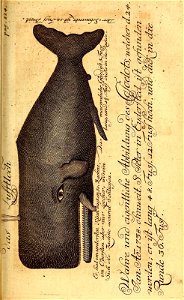
balaenoptera musculus
lawn
itinerario (jan huygen van linschoten)
latin-language maps
animals
sea
human migration
new albion
van langren map of southeast asia
1619 maps of asia
whaling in japan
yasuda raishū
1849 maps of north america
old maps of canada
nova typis transacta navigatio
saint brendan in art
1850s maps of the americas
maps by john tallis
map pack
watch
old maps of svalbard
old maps of iceland
old maps of the chesapeake bay
sir walter raleigh
maps by nicolaes visscher i
old maps of assyria
van langren map of southeast asia
renaissance
prints in the british museum
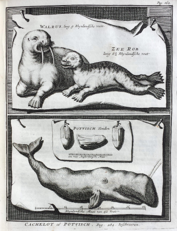
jacob folkema
prints in the british museum
jacob folkema
prints in the british museum
jacob folkema
maps by nicolaes visscher i
old maps of canaan
tower of babel in engravings
maps by nicolaes visscher i
maps by daniel stoopendaal
biblical maps
maps by nicolaes visscher i
maps by daniel stoopendaal
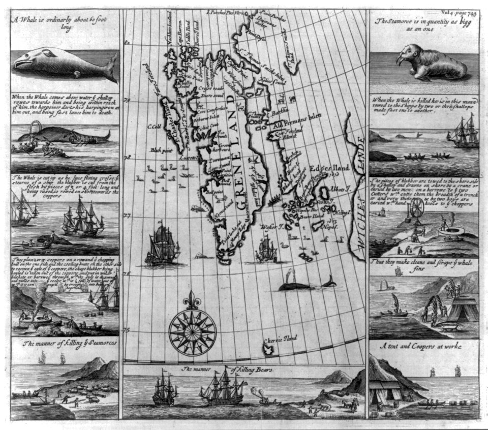
the frozen zone and its explorers (1874)
19th-century maps of greenland
historical
history
historical
history
18th-century maps of antarctica
1741 maps
nature
maps
background
symbol
1 - 39 of 39
/ 1